Here we are at Chapter 2 of the NCERT book for class 9. The chapter name is Physical Features Of India. I hope you were able to solve the first chapter effectively. Chapter 2, Physical Features of India, of the NCERT Geography book for Class 9, takes you to the exploration of India’s diverse physical landscape. In this chapter, you will learn about the formation and characteristics of major geographical features. Some of the features discussed in it are the Himalayas, the Indian Desert, the coastal plains, and the Deccan Plateau. We will learn their significance in the country’s topography and natural environment.
Let’s have a look at some of the important points about the chapter that will help you to revise everything quickly.
- Major Physiographic Divisions:
- The Himalayan Mountains
- The Northern Plains
- The Peninsular Plateau
- The Indian Desert
- The Coastal Plains
- The Islands
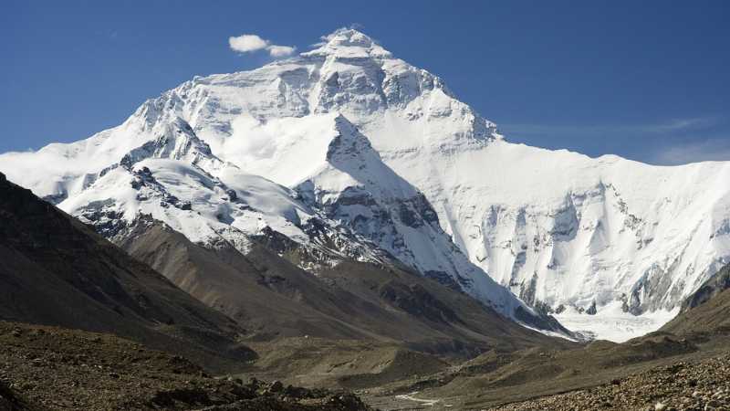
- The Himalayan Mountains:
- Geologically young, fold mountains stretching from Indus to Brahmaputra.
- Consist of three parallel ranges: Himadri (Great Himalayas), Himachal (Lesser Himalayas), and Shiwaliks.
- Contains the highest peaks like Mt. Everest, Kanchenjunga, and Nanda Devi.
- The Northern Plains:
- Formed by the river systems: Indus, Ganga, and Brahmaputra.
- Covers an area of 7 lakh sq. km, with fertile alluvial soil.
- Divided into three sections: Punjab Plains, Ganga Plains, and Brahmaputra Plains.
- The Peninsular Plateau:
- Composed of old crystalline, igneous, and metamorphic rocks.
- Divided into Central Highlands and Deccan Plateau.
- Includes hill ranges like Aravalis, Vindhyas, and Satpuras.
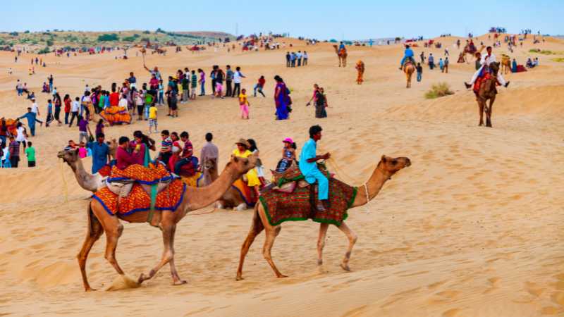
- The Indian Desert:
- Located in the western margins of Aravali Hills.
- Characterized by sandy plains and dunes.
- Receives very low rainfall and has arid climate.
- The Coastal Plains:
- Flanked by narrow coastal strips along the Arabian Sea (west) and Bay of Bengal (east).
- Western Coast: Konkan, Kannad Plain, and Malabar Coast.
- Eastern Coast: Northern Circar and Coromandel Coast.
- The Islands:
- Lakshadweep Islands: Small coral islands in the Arabian Sea.
- Andaman and Nicobar Islands: Larger, more numerous islands in the Bay of Bengal.
- Geological and Physical Variations:
- Peninsular Plateau is one of the oldest landmasses.
- Himalayas and Northern Plains are more recent formations.
- Diverse physical features like mountains, plains, deserts, plateaus, and islands.
- Economic and Cultural Significance:
- Northern Plains are agriculturally productive.
- Himalayas are sources of water and forest wealth.
- Plateaus are rich in minerals.
- Coastal regions support fishing and port activities.
Class 9 Social Science MCQs with Answers are tailored for effective exam prep and follow the latest pattern.
Below are 20 MCQs, multiple choice questions, 10 true and false questions, and 10 fill-in-the-blanks questions. Attempt these once you are thorough with the entire chapter.
Class 9 Geography Chapter 2 MCQs for Physical Features Of India
Find below 20 multiple choice questions (MCQs) with four options each. The options will offer a challenging experience.
Question 1. What is the average width of the Himalayan ranges?
a) 150-200 Km
b) 200-250 Km
c) 250-300 Km
d) 300-350 Km
Answer:
a) 150-200 Km — The average width of the Himalayan ranges is 150-200 Km.
Question 2. The highest peak in the Eastern Ghats is:
a) Anai Mudi
b) Mahendragiri
c) Kanchenjunga
d) Doda Betta
Answer:
b) Mahendragiri — Mahendragiri is the highest peak in the Eastern Ghats.
Question 3. Which river forms the eastern boundary of the Himalayas?
a) Indus
b) Ganga
c) Brahmaputra
d) Teesta
Answer:
c) Brahmaputra — The Brahmaputra river forms the eastern boundary of the Himalayas.
Question 4. The northern plains are formed by the alluvial deposits of which rivers?
a) Ganga, Yamuna, and Saraswati
b) Indus, Ganga, and Brahmaputra
c) Brahmaputra, Mahanadi, and Godavari
d) Kaveri, Krishna, and Tungabhadra
Answer:
b) Indus, Ganga, and Brahmaputra — The northern plains are formed by the alluvial deposits of the Indus, Ganga, and Brahmaputra rivers.
Question 5. Which plateau lies between the Aravali and the Vindhyan ranges?
a) Chotanagpur Plateau
b) Malwa Plateau
c) Deccan Plateau
d) Meghalaya Plateau
Answer:
b) Malwa Plateau — The plateau lying between the Aravali and the Vindhyan ranges is the Malwa Plateau.
Question 6. The Peninsular plateau is a part of which ancient landmass?
a) Laurasia
b) Gondwana land
c) Eurasia
d) Pangaea
Answer:
b) Gondwana land — The Peninsular plateau is a part of the ancient Gondwana land.
Question 7. What type of soil is found in the Deccan Trap region?
a) Alluvial Soil
b) Black Soil
c) Red Soil
d) Laterite Soil
Answer:
b) Black Soil — Black soil is found in the Deccan Trap region.
Question 8. India’s only active volcano is found on:
a) Minicoy Island
b) Barren Island
c) Nicobar Island
d) Andaman Island
Answer:
b) Barren Island — India’s only active volcano is found on Barren Island.
Question 9. Which coastal plain lies between the Western Ghats and the Arabian Sea?
a) Malabar Coast
b) Konkan Coast
c) Coromandel Coast
d) Northern Circar
Answer:
a) Malabar Coast — The coastal plain lying between the Western Ghats and the Arabian Sea is the Malabar Coast.
Question 10. The Eastern Ghats are discontinuous and irregular due to:
a) Volcanic activities
b) Erosion
c) River dissections
d) Earthquakes
Answer:
c) River dissections — The Eastern Ghats are discontinuous and irregular due to river dissections.
Question 11. The Deccan Plateau is mainly drained by which river system?
a) Ganga and Brahmaputra
b) Godavari and Krishna
c) Indus and Ganga
d) Mahanadi and Kaveri
Answer:
b) Godavari and Krishna — The Deccan Plateau is mainly drained by the Godavari and Krishna river systems.
Question 12. Which range forms the eastern boundary of the Indian Desert?
a) Aravali Range
b) Vindhya Range
c) Satpura Range
d) Nilgiri Hills
Answer:
a) Aravali Range — The Aravali Range forms the eastern boundary of the Indian Desert.
Question 13. The oldest mountain range in India is:
a) The Himalayas
b) The Eastern Ghats
c) The Western Ghats
d) The Aravali Range
Answer:
d) The Aravali Range — The Aravali Range is the oldest mountain range in India.
Question 14. The Indian Desert is known for its:
a) Dense forest cover
b) Snow-covered peaks
c) Sand dunes and arid climate
d) Rich biodiversity
Answer:
c) Sand dunes and arid climate — The Indian Desert is known for its sand dunes and arid climate.
Question 15. Which is the highest peak in the Western Ghats?
a) Anai Mudi
b) Doda Betta
c) Nanda Devi
d) Kanchenjunga
Answer:
a) Anai Mudi — Anai Mudi is the highest peak in the Western Ghats.
Question 16. The Narmada River flows through a rift valley formed due to the faulting of:
a) The Himalayas
b) The Vindhyan Range
c) The Aravali Range
d) The Indian Plate
Answer:
b) The Vindhyan Range — The Narmada River flows through a rift valley formed due to the faulting of the Vindhyan Range.
Question 17. The Eastern and Western Ghats meet at:
a) The Nilgiri Hills
b) The Vindhyan Range
c) The Aravali Range
d) The Satpura Range
Answer:
a) The Nilgiri Hills — The Eastern and Western Ghats meet at the Nilgiri Hills.
Question 18. The Patkai hills are located in:
a) The Eastern Himalayas
b) The Western Ghats
c) The Purvanchal Range
d) The Central Highlands
Answer:
c) The Purvanchal Range — The Patkai hills are located in the Purvanchal Range.
Question 19. The Western coastal strip, south of Goa, is referred to as:
a) The Konkan Coast
b) The Coromandel Coast
c) The Kannad Coast
d) The Malabar Coast
Answer:
d) The Malabar Coast — The Western coastal strip, south of Goa, is referred to as the Malabar Coast.
Question 20. The Lakshadweep Islands are located in:
a) The Arabian Sea
b) The Bay of Bengal
c) The Indian Ocean
d) The Andaman Sea
Answer:
a) The Arabian Sea — The Lakshadweep Islands are located in the Arabian Sea.
Question 21. A landmass bounded by sea on three sides is referred to as
a) Coast
b) Island
c) Peninsula
d) None of the above
Answer:
c) Peninsula — A landmass bounded by sea on three sides is referred to as a peninsula.
Question 22. Mountain ranges in the eastern part of India forming its boundary with Myanmar are collectively called
a) Himachal
b) Uttarakhand
c) Purvachal
d) None of the above
Answer:
c) Purvachal — Mountain ranges in the eastern part of India forming its boundary with Myanmar are collectively called Purvachal.
Question 23. The western coastal strip, south of Goa is referred to as
a) Coromandel
b) Konkan
c) Kannad
d) Northern Circar
Answer:
c) Kannad — The western coastal strip, south of Goa is referred to as Kannad.
We hope the above class 9 NCERT Geography chapter 2 MCQs with title Physical Features Of India might have helped you in preparing well. Do let us know your thoughts in the comments section.
Class 9 Geography Chapter 2 Fill in the Blanks Questions for Physical Features Of India
10 fill in the blanks questions, Chapter 2, Physical Features Of India from NCERT Geography book, Class 9 –
Question 1. The Himalayas consist of three parallel ranges in their longitudinal extent, the northern-most of which is known as the __________.
Answer:
Great or Inner Himalayas or the Himadri
Question 2. The Indian Desert lies towards the western margins of the __________ Hills.
Answer:
Aravali
Question 3. The __________ hills and the __________ hills are located to the southeast of the Eastern Ghats.
Answer:
Shevroy, Javadi
Question 4. The northern plain is formed of alluvial soil and stretches over an area of __________ sq. km.
Answer:
7 lakh
Question 5. The Western Ghats are known by different local names and their average elevation is __________ metres.
Answer:
900-1600
Question 6. The __________ plain extends between the Ghaggar and Teesta rivers.
Answer:
Ganga
Question 7. The Eastern Ghats are discontinuous and irregular due to __________ draining into the Bay of Bengal.
Answer:
rivers
Question 8. The part of the Himalayas lying between the Indus and Satluj rivers is known as the __________ Himalayas.
Answer:
Punjab
Question 9. The __________ Lake is the largest saltwater lake in India and lies in the state of Odisha.
Answer:
Chilika
Question 10. The plateau lying to the north of the Narmada River and covering a major area of the Malwa plateau is known as the __________ Highlands.
Answer:
Central
Class 9 Geography Chapter 2 Fill in the Blanks Questions: Physical Features Of India
Here are 10 true & false questions for Chapter 2, Physical Features Of India from the NCERT Geography book for Class 9.
Question 1. The Himalayan Mountains stretch over the northern borders of India for about 2,400 km.
Answer:
True — The Himalayan Mountains do stretch over the northern borders of India for about 2,400 km.
Question 2. The Aravali Range is the oldest mountain range in India.
Answer:
True — The Aravali Range is indeed the oldest mountain range in India.
Question 3. The Indian Desert is also known as the Thar Desert.
Answer:
True — The Indian Desert is indeed also known as the Thar Desert.
Question 4. The Eastern and Western Ghats meet at the Nilgiri Hills.
Answer:
True — The Eastern and Western Ghats do meet at the Nilgiri Hills.
Question 5. The Deccan Plateau is formed entirely of volcanic rocks.
Answer:
False — The Deccan Plateau is not formed entirely of volcanic rocks; it also includes igneous and metamorphic rocks.
Question 6. The Lakshadweep Islands are formed from coral reefs.
Answer:
True — The Lakshadweep Islands are indeed formed from coral reefs.
Question 7. India’s only active volcano is located in the Lakshadweep Islands.
Answer:
False — India’s only active volcano is located on Barren Island in the Andaman and Nicobar Islands.
Question 8. The Ganga Plain is formed of alluvial soil.
Answer:
True — The Ganga Plain is indeed formed of alluvial soil.
Question 9. The Chilika Lake is the largest freshwater lake in India.
Answer:
False — Chilika Lake is a saltwater lake, not a freshwater lake.
Question 10. The Himalayas are geologically the oldest mountains in India.
Answer:
False — The Himalayas are not the oldest mountains in India; the Aravali Range holds this distinction.
Match the following Class 9 Geography Chapter 2 Physical Features Of India
Question
| Column A | Column B |
|---|---|
| (i) Himadri | (a) Formed by the Indus and its tributaries |
| (ii) Bhabar | (b) Northern plains’ fertile soil |
| (iii) Punjab Plains | (c) Narrow belt of pebbles |
| (iv) Khadar | (d) Largest inhabited riverine island |
| (v) Deccan Plateau | (e) Highest peaks with continuous range |
| (vi) Majuli | (f) Triangular landmass in south India |
| (vii) Western Ghats | (g) Easternmost part of the Himalayas |
| (viii) Purvachal | (h) Runs parallel to the western coast |
Answer
| Column A | Column B |
|---|---|
| (i) Himadri | (e) Highest peaks with continuous range |
| (ii) Bhabar | (c) Narrow belt of pebbles |
| (iii) Punjab Plains | (a) Formed by the Indus and its tributaries |
| (iv) Khadar | (b) Northern plains’ fertile soil |
| (v) Deccan Plateau | (f) Triangular landmass in south India |
| (vi) Majuli | (d) Largest inhabited riverine island |
| (vii) Western Ghats | (h) Runs parallel to the western coast |
| (viii) Purvachal | (g) Easternmost part of the Himalayas |
Distinguish between the following
1. Distinguish between Bhangar and Khadar
| Bhangar | Khadar |
|---|---|
| Older alluvium | Newer, younger alluvium |
| Forms terraces above floodplains | Located in the floodplains |
| Contains calcareous deposits (kankar) | Renewed every year |
| Less fertile than Khadar | More fertile, ideal for intensive agriculture |
2. Distinguish between Western Ghats and Eastern Ghats
| Western Ghats | Eastern Ghats |
|---|---|
| Runs parallel to the western coast | Stretches from Mahanadi Valley to Nilgiris |
| Continuous and can be crossed through passes | Discontinuous and irregular |
| Higher in elevation (900–1600 meters) | Lower in elevation (average 600 meters) |
| Known for orographic rain | Dissected by rivers draining into the Bay of Bengal |