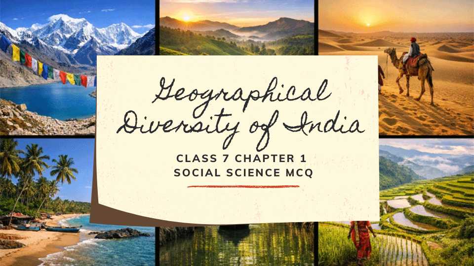
India is one of the most geographically diverse countries in the world. From the Himalayas in the north to tropical coastlines in the south, India truly feels like a world within a world.
Chapter 1 of the Class 7 Social Science textbook Exploring Society: India and Beyond takes students on a geographical journey across India. It is part of the India and the World: Land and the People unit.
Here is a quick look at what this social science chapter covers:
- The Himalayas – formation, three main ranges, and the cold desert of Ladakh
- The Gangetic Plains – fertile river plains supporting agriculture and a large population
- The Thar Desert – a vast arid region where people have adapted to harsh conditions
- The Aravalli Hills – among the oldest mountain ranges in the world
- The Peninsular Plateau – ancient landmass bordered by Western and Eastern Ghats
- Coastlines and Islands – west coast, east coast, Lakshadweep, and Andaman and Nicobar Islands
- Sundarbans and Northeast Hills – mangrove delta and biodiversity-rich hills of Meghalaya
This chapter helps students understand why India’s climate, culture, and way of life vary so much from region to region. Geography shapes everything, from crops grown to festivals celebrated.
To test your understanding, we have put together a set of MCQ questions for Class 7 Social Science based on this chapter. In the questions below, you will find MCQs, fill in the blank, match the following, true and false etc. type of questions.
Class 7 Geographical Diversity of India MCQ Social Science Questions with Answers
Class 7 SST Chapter 1 Geographical Diversity of India MCQ Questions
1. Which statement best explains why India is often described as geographically diverse?
a) It has only mountains and plateaus
b) It includes mountains, plains, deserts, plateaus, coasts, and islands
c) It is made up only of river valleys
d) It has the same climate in all regions
Answer:
b) It includes mountains, plains, deserts, plateaus, coasts, and islands
2. Which natural feature has acted as a major barrier in the north of India?
a) Aravalli Hills
b) Western Ghats
c) Himalayas
d) Deccan Plateau
Answer:
c) Himalayas
3. Why are the Himalayas called the “Water Tower of Asia”?
a) They receive the least rainfall in Asia
b) Many major rivers originate from them
c) They contain the largest man-made dams
d) They are surrounded by oceans
Answer:
b) Many major rivers originate from them
4. Which of the following correctly matches the Himalayan range with its feature?
a) Shivalik – highest and most rugged
b) Himachal – outermost and lowest
c) Himadri – snow-covered and sparsely populated
d) Himadri – famous for dense agriculture
Answer:
c) Himadri – snow-covered and sparsely populated
5. According to the chapter, the Himalayas were formed mainly because
a) volcanic lava cooled rapidly
b) the Indian landmass collided with Eurasia
c) rivers deposited sediments over time
d) ocean water carved deep valleys
Answer:
b) the Indian landmass collided with Eurasia
6. Gaumukh is important because it is associated with the origin of the
a) Yamuna River
b) Brahmaputra River
c) Bhagirathi River
d) Narmada River
Answer:
c) Bhagirathi River
7. Which region of India is described in the chapter as a cold desert?
a) Kachchh
b) Ladakh
c) Thar
d) Bundelkhand
Answer:
b) Ladakh
8. Pangong Tso is unusual among lakes because its water is
a) extremely hot
b) completely frozen all year
c) salty
d) bright green
Answer:
c) salty
9. Which of the following best explains the fertility of the Gangetic Plains?
a) Their rocky soil is ideal for cultivation
b) Minerals brought by rivers enrich the soil
c) They are unaffected by floods
d) They receive no river water
Answer:
b) Minerals brought by rivers enrich the soil
10. The flat land of the Northern Plains has especially helped the growth of
a) only forests
b) only animal grazing
c) transport networks and agriculture
d) volcanoes and waterfalls
Answer:
c) transport networks and agriculture
11. Sand dunes in the Thar Desert are mainly formed by
a) earthquakes
b) glacial movement
c) shifting winds
d) underground rivers
Answer:
c) shifting winds
12. Which mountain range helps prevent the Thar Desert from expanding further eastward?
a) Himalayas
b) Aravallis
c) Eastern Ghats
d) Vindhyas
Answer:
b) Aravallis
13. Which statement about the Peninsular Plateau is correct?
a) It is surrounded by water on two sides
b) It is the youngest landform in India
c) It is bordered by the Western Ghats and Eastern Ghats
d) All its rivers flow westward
Answer:
c) It is bordered by the Western Ghats and Eastern Ghats
14. Why do many major rivers of the Peninsular Plateau flow towards the Bay of Bengal?
a) The plateau tilts slightly to the east
b) The Himalayas block them in the west
c) The Arabian Sea is at a higher level
d) The rivers start in the Sundarbans
Answer:
a) The plateau tilts slightly to the east
15. Which pair is correctly matched?
a) Lakshadweep – volcanic islands in the Bay of Bengal
b) Andaman and Nicobar – coral islands near Kerala
c) Sundarbans – delta region with mangroves
d) West Coast – broad deltas of Godavari and Krishna
Answer:
c) Sundarbans – delta region with mangroves
Geographical Diversity of India Class 7 Assertion-Reason Questions
1. Assertion (A): The Himalayas are important to millions of people. Reason (R): They feed major rivers that provide water for farming, drinking, and industry.
a) Both A and R are true, and R is the correct explanation of A
b) Both A and R are true, but R is not the correct explanation of A
c) A is true, but R is false
d) A is false, but R is true
Answer:
a) Both A and R are true, and R is the correct explanation of A
2. Assertion (A): Human settlements are fewer in the Himadri region. Reason (R): The region remains snow-covered throughout the year and life is difficult there.
a) Both A and R are true, and R is the correct explanation of A
b) Both A and R are true, but R is not the correct explanation of A
c) A is true, but R is false
d) A is false, but R is true
Answer:
a) Both A and R are true, and R is the correct explanation of A
3. Assertion (A): Ladakh is called “moonland.” Reason (R): Its rugged terrain resembles the surface of the moon.
a) Both A and R are true, and R is the correct explanation of A
b) Both A and R are true, but R is not the correct explanation of A
c) A is true, but R is false
d) A is false, but R is true
Answer:
a) Both A and R are true, and R is the correct explanation of A
4. Assertion (A): The Gangetic Plains are densely populated. Reason (R): The region has fertile soil, river water, and good transport networks.
a) Both A and R are true, and R is the correct explanation of A
b) Both A and R are true, but R is not the correct explanation of A
c) A is true, but R is false
d) A is false, but R is true
Answer:
a) Both A and R are true, and R is the correct explanation of A
5. Assertion (A): Life in the Thar Desert requires special adaptation. Reason (R): Water is scarce and temperatures are extreme.
a) Both A and R are true, and R is the correct explanation of A
b) Both A and R are true, but R is not the correct explanation of A
c) A is true, but R is false
d) A is false, but R is true
Answer:
a) Both A and R are true, and R is the correct explanation of A
6. Assertion (A): The Aravallis are important for northwestern India. Reason (R): They act as a natural barrier against the eastward spread of the Thar Desert.
a) Both A and R are true, and R is the correct explanation of A
b) Both A and R are true, but R is not the correct explanation of A
c) A is true, but R is false
d) A is false, but R is true
Answer:
a) Both A and R are true, and R is the correct explanation of A
7. Assertion (A): The Peninsular Plateau is called a peninsula. Reason (R): It is surrounded by water on three sides.
a) Both A and R are true, and R is the correct explanation of A
b) Both A and R are true, but R is not the correct explanation of A
c) A is true, but R is false
d) A is false, but R is true
Answer:
a) Both A and R are true, and R is the correct explanation of A
8. Assertion (A): The West Coast has many estuaries. Reason (R): Many short rivers from the Western Ghats flow swiftly into the Arabian Sea.
a) Both A and R are true, and R is the correct explanation of A
b) Both A and R are true, but R is not the correct explanation of A
c) A is true, but R is false
d) A is false, but R is true
Answer:
a) Both A and R are true, and R is the correct explanation of A
Geographical Diversity of India Class 7 Fill in the blanks Questions
1. India, along with its neighbouring countries, forms the region known as the __________.
Answer:
Indian Subcontinent
2. The highest and most rugged Himalayan range is called the __________.
Answer:
Himadri
3. The Bhagirathi River originates from __________ in Uttarakhand.
Answer:
Gaumukh
4. Ladakh is described in the chapter as a __________ desert.
Answer:
cold
5. The vast fertile plains south of the Himalayas are called the __________ Plains.
Answer:
Gangetic
6. The Thar Desert mainly spreads across Rajasthan, Gujarat, Punjab, and __________.
Answer:
Haryana
7. The Aravallis help stop the Thar Desert from spreading further towards the __________.
Answer:
east
8. Between the Western Ghats and Eastern Ghats lies the __________ Plateau.
Answer:
Deccan
9. Lakshadweep is an archipelago in the __________ Sea.
Answer:
Arabian
10. The only active volcano in India is on __________ Island.
Answer:
Barren
Geographical Diversity of India Class 7 True or False Questions
1. India is the seventh-largest country in the world.
Answer:
True
2. The Shivalik Hills are the highest Himalayan range.
Answer:
False
3. Ladakh receives heavy rainfall throughout the year.
Answer:
False
4. Pangong Tso is known for its salty water.
Answer:
True
5. The Gangetic Plains are poor for farming because the soil lacks minerals.
Answer:
False
6. Sand dunes in the Thar Desert may rise as high as 150 metres.
Answer:
True
7. The Western Ghats are lower and more broken than the Eastern Ghats.
Answer:
False
8. Some rivers of the Peninsular Plateau flow westward into the Arabian Sea.
Answer:
True
9. Lakshadweep consists of volcanic islands.
Answer:
False
10. The Sundarbans lie in the delta of the Ganga, Brahmaputra, and their tributaries.
Answer:
True
Geographical Diversity of India Class 7 Match the following Questions
Question 1
| Column A | Column B |
|---|---|
| 1. Himadri | A. Cold desert of India |
| 2. Ladakh | B. Helps stop eastward spread of the Thar |
| 3. Aravallis | C. Highest Himalayan range |
| 4. Deccan Plateau | D. Lies between Western and Eastern Ghats |
| 5. Sundarbans | E. Mangrove delta region |
Answer:
| Column A | Correct Answer |
|---|---|
| 1. Himadri | C. Highest Himalayan range |
| 2. Ladakh | A. Cold desert of India |
| 3. Aravallis | B. Helps stop eastward spread of the Thar |
| 4. Deccan Plateau | D. Lies between Western and Eastern Ghats |
| 5. Sundarbans | E. Mangrove delta region |
Question 2
| Column A | Column B |
|---|---|
| 1. Lakshadweep | A. Important lagoon on the East Coast |
| 2. Barren Island | B. Coral islands in the Arabian Sea |
| 3. Pulicat Lake | C. Active volcano |
| 4. Brahmaputra | D. River system helping form fertile plains |
| 5. Khasi Hills | E. Part of the Meghalaya Plateau |
Answer:
| Column A | Correct Answer |
|---|---|
| 1. Lakshadweep | B. Coral islands in the Arabian Sea |
| 2. Barren Island | C. Active volcano |
| 3. Pulicat Lake | A. Important lagoon on the East Coast |
| 4. Brahmaputra | D. River system helping form fertile plains |
| 5. Khasi Hills | E. Part of the Meghalaya Plateau |