India shares land borders with six countries and sea borders with two. But if you look at a map properly, the connections go much further. Indian traders were sailing to Indonesia 2,000 years ago. Hindu merchants built temples in China in the 13th century. The name of Bangkok’s airport goes by today, has its roots in the Mahabharata. Borders on paper and connections in reality are two very different things.
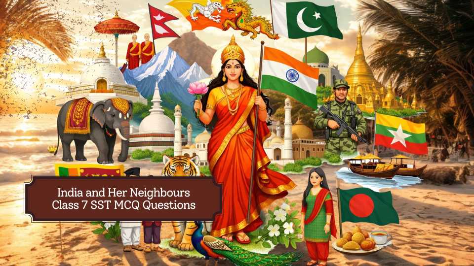
Chapter 2 of Exploring Society: India and Beyond, Grade 7 Part 2 is titled India and Her Neighbours, from the unit India and the World: Land and the People. It is one of the longer chapters in this book and covers a lot of ground, literally.
Most students expect this to be a chapter about maps and border lengths. It is that, but it is also about Buddhism travelling from India to China in the 1st century CE, about a visa-free corridor opened in 2019 so pilgrims could visit a gurdwara in Pakistan, about a cabinet meeting held 4 metres underwater to draw attention to rising sea levels, and about how the word “Singapore” comes from the Sanskrit “Singapuram.” The geography is the starting point. The history and culture are what make it worth reading.
Before you start with the questions, let’s take a quick look at what this chapter covers:
- India’s land boundary: Over 15,100 km through deserts, plains, mountains, forests, and river valleys.
- India’s coastline: Around 11,100 km, placing India between Southeast Asia, West Asia, and Africa.
- The Indian Ocean: Two-thirds of the world’s oil and half its container ships pass through it.
- Maritime neighbours: Countries linked by sea, not land. Sri Lanka and Maldives are closest; Thailand, Malaysia, Singapore, Indonesia, and Oman are part of the wider maritime neighbourhood.
- SAARC, 1985: Eight South Asian nations working together on health, education, science, and development.
- India and China: Buddhism reached China from India in the 1st century CE. Today, China exports about eight times more to India than it imports.
- India-Pakistan wars: 1948, 1965, 1971, and the Kargil conflict in 1999.
- Kartarpur Corridor, 2019: Visa-free crossing for Indian pilgrims to visit Guru Nanak Dev’s final resting place in Pakistan.
- Bangladesh, 1971: Born after the India-Pakistan war. The shared border is longer than India’s border with China.
- Sundarbans: A UNESCO World Heritage Site and the world’s largest mangrove forest, jointly managed by India and Bangladesh.
- India-Nepal Treaty, 1950: Open borders, free movement of people and goods, no passport or visa needed.
- Bhutan: Called “Drukyul” or Land of the Thunder Dragon. Rivers from Bhutan power hydroelectric projects supplying renewable energy to India.
- Three schools of Buddhism from India: Theravada, around 3rd century BCE, Mahayana around 1st century BCE, and Vajrayana around 6th century CE, each spreading to different parts of Asia.
- Myanmar: India’s gateway to Southeast Asia, sharing borders with four northeastern states. Land Border Crossing Agreement signed in 2018.
- Afghanistan: Once had a direct land border with India. India helped build the Afghan Parliament and the Zaranj-Delaram highway. The Buddhas of Bamiyan, symbols of Buddhist reach from India, were destroyed in 2001.
- Sri Lanka: Only 32 km from India at the nearest point. Buddhism arrived here in the 3rd century BCE. Civil war lasted from the mid-1980s to around 2010.
- Maldives: Over 1,100 islets, 130 km from India’s Minicoy island. India helped during the 2004 tsunami, 2014 water crisis, and COVID-19 pandemic. Rising seas could submerge much of the country by end of this century.
- Thailand: The Ayutthaya Kingdom, founded 1351, was named after Ayodhya. All kings of the current Chakri dynasty are named after Rama. The current king is Rama X.
- Malaysia: Adopted a Brahmi-based script in the 4th century CE. Nine percent of the population is of Indian origin, many descended from plantation workers who migrated in the 19th and 20th centuries.
- Singapore: Name from Sanskrit “Singapuram.” Tamil is one of four official languages. Nine percent of residents are of Indian origin.
- Indonesia: Over 17,000 islands. The Borobudur Stupa, built 8th-9th century CE, is the world’s largest Buddhist monument. The 2004 tsunami killed over 200,000 people across the region, leading India to set up the Tsunami Early Warning Centre in Hyderabad.
- Iran: Trade links since the Bronze Age. Persian belongs to the same language family as Sanskrit.
- Oman: People-to-people ties going back over 5,000 years to Harappan times. Over 10% of Oman’s population is of Indian origin. India’s closest defence partner in the Gulf.
This chapter is vast and might look like a list of countries with facts attached. A single idea that emerges from this chapter is that India did not spread its influence by force. Buddhism, Sanskrit, trade, architecture, food, and language travelled across borders because people carried them. The connections described in this book were built over centuries, not negotiated in a meeting room. That is what makes this chapter different from a political map.
See how much of it you have actually absorbed with these MCQ questions for Class 7 Social Science.
Class 7 India and Her Neighbours Part 2 MCQ Questions with Answers
Class 7 SST Chapter 2 India and Her Neighbours Part 2 MCQ Questions
1. Which of the following is the best meaning of a maritime neighbour?
a) A country sharing only a mountain border
b) A country connected through a shared sea or ocean
c) A country located on the same continent only
d) A country with the same language
Answer:
b) A country connected through a shared sea or ocean
2. Which three large water bodies surround India?
a) Arctic Ocean, Bay of Bengal, Arabian Sea
b) Arabian Sea, Bay of Bengal, Indian Ocean
c) Mediterranean Sea, Indian Ocean, Bay of Bengal
d) Arabian Sea, Red Sea, Indian Ocean
Answer:
b) Arabian Sea, Bay of Bengal, Indian Ocean
3. Why does India hold a unique maritime position?
a) It is a landlocked country
b) It has no access to major sea routes
c) Its peninsular shape extends deep into the Indian Ocean
d) It lies only in the Northern Hemisphere
Answer:
c) Its peninsular shape extends deep into the Indian Ocean
4. Which idea in the chapter refers to countries working together for peace, stability, and shared progress?
a) Federalism
b) Regionalism
c) Colonialism
d) Urbanisation
Answer:
b) Regionalism
5. Which country is described as India’s largest neighbour in the chapter?
a) Bangladesh
b) Pakistan
c) China
d) Nepal
Answer:
c) China
6. Which mountain range separates India and China?
a) Aravalli
b) Vindhya
c) Satpura
d) Himalayas
Answer:
d) Himalayas
7. Which pair of Chinese monks travelled to Indian centres of learning?
a) Mahendra and Sanghamitra
b) Faxian and Xuanzang
c) Bodhidharma and Kumarajiva
d) Guru Padmasambhava and Rinpoche
Answer:
b) Faxian and Xuanzang
8. Which statement about India-China trade is correct according to the chapter?
a) India exports much more to China than it imports
b) Trade has completely stopped
c) China’s exports to India are worth about eight times India’s exports to China
d) India imports only cotton yarn from China
Answer:
c) China’s exports to India are worth about eight times India’s exports to China
9. Before 1947, Pakistan was
a) a separate island nation
b) a part of India
c) a British colony in Africa
d) a part of Nepal
Answer:
b) a part of India
10. Which of the following is a visa-free border crossing between India and Pakistan for pilgrims?
a) Palk Strait
b) Kartarpur Corridor
c) Tio River Crossing
d) Chabahar Route
Answer:
b) Kartarpur Corridor
11. Bangladesh was earlier known as
a) West Pakistan
b) East Pakistan
c) Burma
d) Ceylon
Answer:
b) East Pakistan
12. Which shared natural feature is important to both India and Bangladesh?
a) Thar Desert
b) Sundarban National Park
c) Deccan Plateau
d) Palk Strait
Answer:
b) Sundarban National Park
13. Which country’s border with India is described as open, allowing movement without passports or visas?
a) Bhutan
b) Nepal
c) Myanmar
d) Sri Lanka
Answer:
b) Nepal
14. The 1950 Treaty of Peace and Friendship is associated with India and
a) Nepal
b) Bangladesh
c) Maldives
d) Indonesia
Answer:
a) Nepal
15. Which country is called Drukyul or the Land of the Thunder Dragon?
a) Thailand
b) Bhutan
c) Myanmar
d) Sri Lanka
Answer:
b) Bhutan
16. Which major area of cooperation between India and Bhutan is based on rivers flowing from Bhutan into India?
a) Silk production
b) Hydroelectric power generation
c) Ship building
d) Space exploration
Answer:
b) Hydroelectric power generation
17. Which country is called India’s gateway to Southeast Asia in the chapter?
a) Sri Lanka
b) Singapore
c) Myanmar
d) Malaysia
Answer:
c) Myanmar
18. The Land Border Crossing Agreement of 2018 mentioned in the chapter is between India and
a) Myanmar
b) China
c) Thailand
d) Afghanistan
Answer:
a) Myanmar
19. Which country once shared a direct land border with India, but access became complicated after the creation of Pakistan in 1947?
a) Iran
b) Afghanistan
c) Indonesia
d) Maldives
Answer:
b) Afghanistan
20. Which narrow stretch of sea separates India and Sri Lanka?
a) Strait of Malacca
b) Palk Strait
c) Sunda Strait
d) Bab-el-Mandeb
Answer:
b) Palk Strait
21. Which country is only about 130 km from Minicoy, making it an important neighbour for trade and security in the Indian Ocean?
a) Oman
b) Sri Lanka
c) Maldives
d) Singapore
Answer:
c) Maldives
22. Which country’s name is derived from Singapuram or lion city?
a) Malaysia
b) Thailand
c) Singapore
d) Indonesia
Answer:
c) Singapore
India and Her Neighbours Class 7 Part 2 Assertion-Reason Questions
1. Assertion (A): India can have neighbours across the sea even without sharing a land border. Reason (R): A maritime neighbour is a country connected through a shared sea or ocean.
a) Both A and R are true, and R is the correct explanation of A
b) Both A and R are true, but R is not the correct explanation of A
c) A is true, but R is false
d) A is false, but R is true
Answer:
a) Both A and R are true, and R is the correct explanation of A
2. Assertion (A): India plays an important regional role in the Indian Ocean. Reason (R): India has a peninsular shape, access to major sea routes, and ports that help in trade and relief work.
a) Both A and R are true, and R is the correct explanation of A
b) Both A and R are true, but R is not the correct explanation of A
c) A is true, but R is false
d) A is false, but R is true
Answer:
a) Both A and R are true, and R is the correct explanation of A
3. Assertion (A): India and Nepal have a special relationship based on an open border. Reason (R): Citizens of both countries can cross the border without passports or visas.
a) Both A and R are true, and R is the correct explanation of A
b) Both A and R are true, but R is not the correct explanation of A
c) A is true, but R is false
d) A is false, but R is true
Answer:
a) Both A and R are true, and R is the correct explanation of A
4. Assertion (A): Bhutan is called the Land of the Thunder Dragon. Reason (R): The dragon on Bhutan’s emblem and flag symbolises the thunderous voice of the Buddha’s teachings.
a) Both A and R are true, and R is the correct explanation of A
b) Both A and R are true, but R is not the correct explanation of A
c) A is true, but R is false
d) A is false, but R is true
Answer:
a) Both A and R are true, and R is the correct explanation of A
5. Assertion (A): India and Sri Lanka are close maritime neighbours. Reason (R): The two countries are divided by the Palk Strait and are only about 32 km apart at the nearest point.
a) Both A and R are true, and R is the correct explanation of A
b) Both A and R are true, but R is not the correct explanation of A
c) A is true, but R is false
d) A is false, but R is true
Answer:
a) Both A and R are true, and R is the correct explanation of A
India and Her Neighbours Class 7 Part 2 Fill in the blanks Questions
1. A country connected to another by a shared sea or ocean is called a __________ neighbour.
Answer:
maritime
2. India’s total land boundary stretches over __________ km.
Answer:
15,100
3. The Indian Ocean is the __________ largest ocean in the world.
Answer:
third
4. Buddhism reached China around the __________ century CE from India.
Answer:
1st
5. The visa-free crossing for pilgrims between India and Pakistan is called the __________ Corridor.
Answer:
Kartarpur
6. Bangladesh was born in __________ as the outcome of a war between India and Pakistan.
Answer:
1971
7. The major Hindu pilgrimage site in Kathmandu is the __________ temple.
Answer:
Pashupatinatha
8. Bhutan developed the concept of Gross National __________ Index.
Answer:
Happiness
9. The Land Border Crossing Agreement between India and Myanmar was signed in __________.
Answer:
2018
10. Sri Lanka is separated from India by the narrow stretch of sea known as the __________ Strait.
Answer:
Palk
11. The official language of the Maldives is called __________.
Answer:
Dhivehi
India and Her Neighbours Class 7 Part 2 True or False Questions
1. India’s neighbourhood is defined only by countries sharing a land border.
Answer:
False
2. India’s ports serve as gateways for imports and exports.
Answer:
True
3. Buddhism is described in the chapter as a cultural link between India and China.
Answer:
True
4. Pakistan was founded on the same basis as India.
Answer:
False
5. The Sundarban National Park is managed in coordination by India and Bangladesh.
Answer:
True
6. Citizens of India and Nepal need passports and visas for crossing the open border.
Answer:
False
7. Guru Padmasambhava introduced the Vajrayana school of Buddhism to Bhutan.
Answer:
True
8. Myanmar is described in the chapter as India’s gateway to West Asia.
Answer:
False
9. Afghanistan is an island country in the Indian Ocean.
Answer:
False
10. SAARC was formed in 1985.
Answer:
True
11. Sri Lanka’s civil war caused many Tamil families to move to south India.
Answer:
True
12. Singapore’s Tamil language status suggests there are no historical links with south India.
Answer:
False
India and Her Neighbours Class 7 Part 2 Match the following Questions
Question 1
| Column A | Column B |
|---|---|
| 1. China | A. Open border policy |
| 2. Pakistan | B. India’s largest neighbour |
| 3. Bangladesh | C. Kartarpur Corridor |
| 4. Nepal | D. Sundarban National Park |
| 5. Bhutan | E. Land of the Thunder Dragon |
Answer:
| Column A | Correct Answer |
|---|---|
| 1. China | B. India’s largest neighbour |
| 2. Pakistan | C. Kartarpur Corridor |
| 3. Bangladesh | D. Sundarban National Park |
| 4. Nepal | A. Open border policy |
| 5. Bhutan | E. Land of the Thunder Dragon |
Question 2
| Column A | Column B |
|---|---|
| 1. Myanmar | A. Palk Strait |
| 2. Afghanistan | B. Gateway to Southeast Asia |
| 3. Sri Lanka | C. Once shared a direct land border with India |
| 4. Maldives | D. About 130 km from Minicoy |
| 5. Singapore | E. Lion City |
Answer:
| Column A | Correct Answer |
|---|---|
| 1. Myanmar | B. Gateway to Southeast Asia |
| 2. Afghanistan | C. Once shared a direct land border with India |
| 3. Sri Lanka | A. Palk Strait |
| 4. Maldives | D. About 130 km from Minicoy |
| 5. Singapore | E. Lion City |